Enhancing GPS and Mapping with Device Orientation API
- Post
- August 8, 2023
- Device Orientation API, Web APIs, Web Technologies
- 0 Comments
In a world where accurate navigation and mapping are integral to our daily lives, the fusion of technology and geolocation services is propelling us into a new era of precision and convenience. One of the most exciting advancements in this realm is the integration of the Device Orientation API with GPS and mapping systems. This innovation promises to revolutionize how we interact with maps, unlocking a host of possibilities for both developers and end-users. In this comprehensive guide, we delve deep into the intricacies of the Device Orientation API, its potential applications, and how it complements GPS and mapping technologies seamlessly.
Understanding the Device Orientation API
Device Orientation API Unveiled
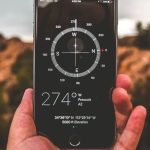
The Device Orientation API is a browser-based technology that allows web applications to access real-time data from a device’s gyroscope, accelerometer, and magnetometer. This data, combined with existing GPS information, enables a more holistic understanding of a device’s position and orientation in physical space. This newfound synergy equips developers with the tools to create immersive experiences that bridge the gap between the virtual and physical worlds.
Device Orientation Examples: Bridging the Gap
The potential applications of the Device Orientation API are vast and diverse. For instance, imagine a navigation app that not only provides turn-by-turn directions but also augments reality by displaying arrows overlaid on the user’s live camera feed, guiding them intuitively through unfamiliar streets. Additionally, architectural and urban planning tools can leverage this technology to superimpose virtual building models onto the real world, aiding in visualizing construction projects seamlessly.
The Synergy: GPS and Device Orientation API
Enhancing GPS Accuracy
The marriage of GPS and the Device Orientation API holds immense promise in refining location accuracy. Traditional GPS systems can sometimes falter in urban canyons or dense forests due to limited line-of-sight to satellites. However, by integrating data from the Device Orientation API, the device’s orientation can be factored in to infer a more precise location, even when direct GPS signals are intermittent.
Dynamic Mapping with Real-time Adjustments
When utilizing maps for navigation, current GPS systems may display a fixed north-oriented map, making it challenging to correlate real-world orientation with the map’s perspective. With the Device Orientation API, maps can dynamically adjust their orientation based on the device’s heading, ensuring a seamless alignment between the user’s viewpoint and the digital map.
Developers’ Delight: Implementing the API
Implementing Device Orientation API
For developers eager to harness the power of the Device Orientation API, the integration process is relatively straightforward. By accessing the API through JavaScript, developers can obtain real-time data from a device’s sensors, including pitch, roll, and yaw. This data can then be used to create immersive experiences, such as 3D navigation interfaces or interactive AR applications.
Challenges and Solutions
While the Device Orientation API offers a plethora of opportunities, it’s not without its challenges. Calibrating sensors accurately and dealing with potential discrepancies in sensor data require careful consideration. However, the developer community has provided solutions, such as sensor fusion algorithms that combine data from multiple sensors to enhance accuracy.
Real-world Applications: From Gaming to Navigation
Gaming and Entertainment
Beyond navigation, the Device Orientation API has ignited a revolution in the gaming and entertainment industries. Augmented reality games, such as treasure hunts superimposed on real-world locations, have captivated players by seamlessly blending the virtual and physical realms. Similarly, virtual tours of historical sites, museums, and art galleries offer immersive experiences that transport users across time and space.
Industrial and Architectural Visualization
Industries like architecture and urban planning benefit significantly from the integration of the Device Orientation API with mapping. Architects can create virtual walkthroughs of buildings before construction begins, allowing clients to visualize designs more accurately. Urban planners can simulate the impact of new infrastructure projects on a city’s landscape, enabling data-driven decision-making.
Commonly Asked Questions
Q1: How does the Device Orientation API enhance traditional GPS navigation?
A1: The Device Orientation API augments traditional GPS navigation by providing real-time data from a device’s sensors. This data helps improve accuracy in areas with limited GPS signal, while also aligning the map’s orientation with the user’s real-world perspective.
Q2: Can the Device Orientation API be used for indoor navigation?
A2: Yes, the API’s fusion of sensor data with GPS information makes it a valuable tool for indoor navigation, where GPS signals might be weak or unavailable. By incorporating gyroscope and accelerometer data, developers can create indoor navigation experiences with high precision.
Q3: How accurate is the Device Orientation API?
A3: The accuracy of the Device Orientation API depends on sensor calibration and data fusion algorithms. When properly implemented, it can provide a high level of accuracy for orientation and positioning, enhancing various applications such as gaming, navigation, and architectural visualization.
Q4: What challenges do developers face when implementing the Device Orientation API?
A4: Developers may encounter challenges related to sensor calibration, data synchronization, and compatibility across different devices. However, these challenges can be addressed through thorough testing, calibration techniques, and the use of sensor fusion algorithms.
Q5: Are there security concerns associated with using the Device Orientation API?
A5: Security concerns are present with any technology that accesses sensor data. Developers should ensure that user privacy is upheld and that the collected data is used only for intended purposes. Implementing secure coding practices and adhering to privacy regulations is crucial.
Final Words
In an ever-evolving technological landscape, the fusion of the Device Orientation API with GPS and mapping technologies has ushered in a new era of spatial awareness. From enhancing navigation accuracy to creating immersive gaming experiences, this innovative integration holds boundless potential. As developers continue to explore its capabilities and address challenges, we can anticipate a future where digital maps seamlessly align with the physical world, enriching our interactions and understanding of the environments around us.